Irish Geography
Goals ~ Games ~ Books ~ Maps & Globe ~ Workbooks ~ Field Trips
Goals
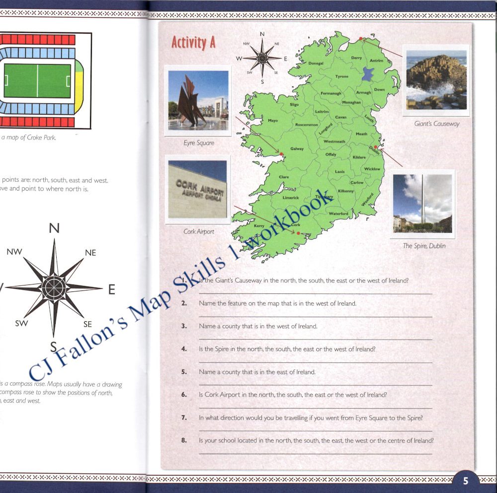
It is always important for me to think about my why before selecting a resource. Sometimes I need to look around to get ideas and see what is possible. Sometimes, like with the overwhelming number of Irish geography school workbooks, and with most of them being shrink-wrapped so I could not see inside, that just ends up simply confusing the matter. However after some effort, and having looked through the Irish primary school geography curriculum and asking around, I was able to articulate that what I want is for my children to be able to name and locate:
- Ireland’s Provinces and Counties
- Ireland’s Cities and Major Towns
- Ireland’s Mountains and Islands
- Ireland’s Rivers and Lakes
- Ireland’s Bays and Headlands
- Ireland’s Airports and Ferry Ports
- And be able to name and locate some of the major tourist attractions of Ireland.
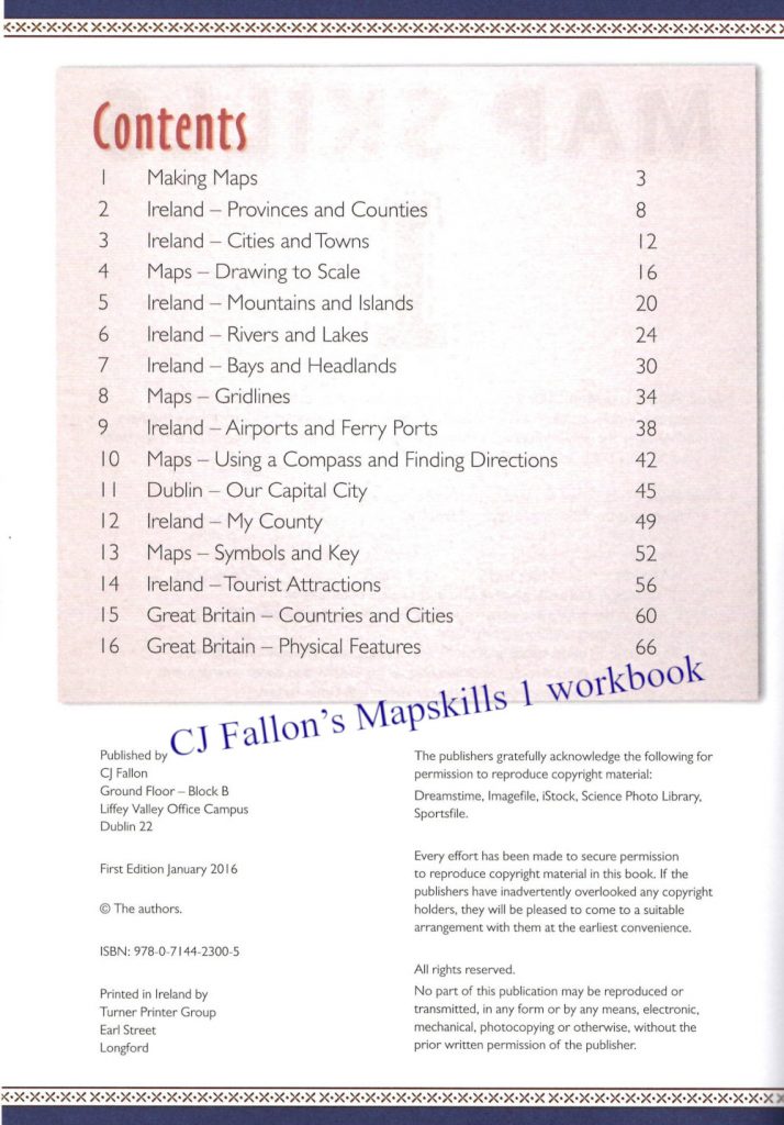
The Table of Contents from CJ Fallon’s Mapskills 1 workbook was the most helpful in making the above list.
Games
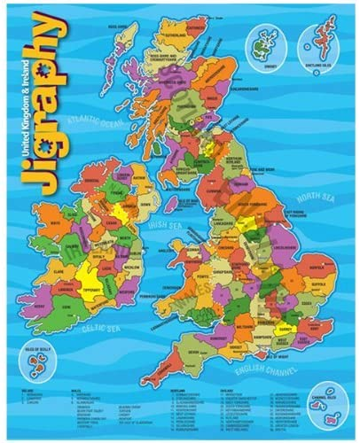
Starting off with learning the provinces and counties, I think that time with one of the wooden map of Ireland puzzles, where each piece is the shape of the county is a great hands on way of learning the counties. We have a Montessori puzzle map of the Irish counties, and my Montessori directress friend Kate recommended that I teach just a few counties each time we sit down with the puzzle. There is also a Jigraphy map of the United Kingdom & Ireland, but make sure to buy the one where the puzzle pieces are the shapes of the counties and not just jigsaw pieces – they have two types. This is cardboard so the pieces are breakable, thus I think it is better for perhaps 6+, but you will know how roughly your child is likely to handle the pieces.
I may include referral links below. If you click through one of these and take action, I may be compensated (at no cost to you!). You can read my full disclosure here.
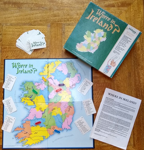
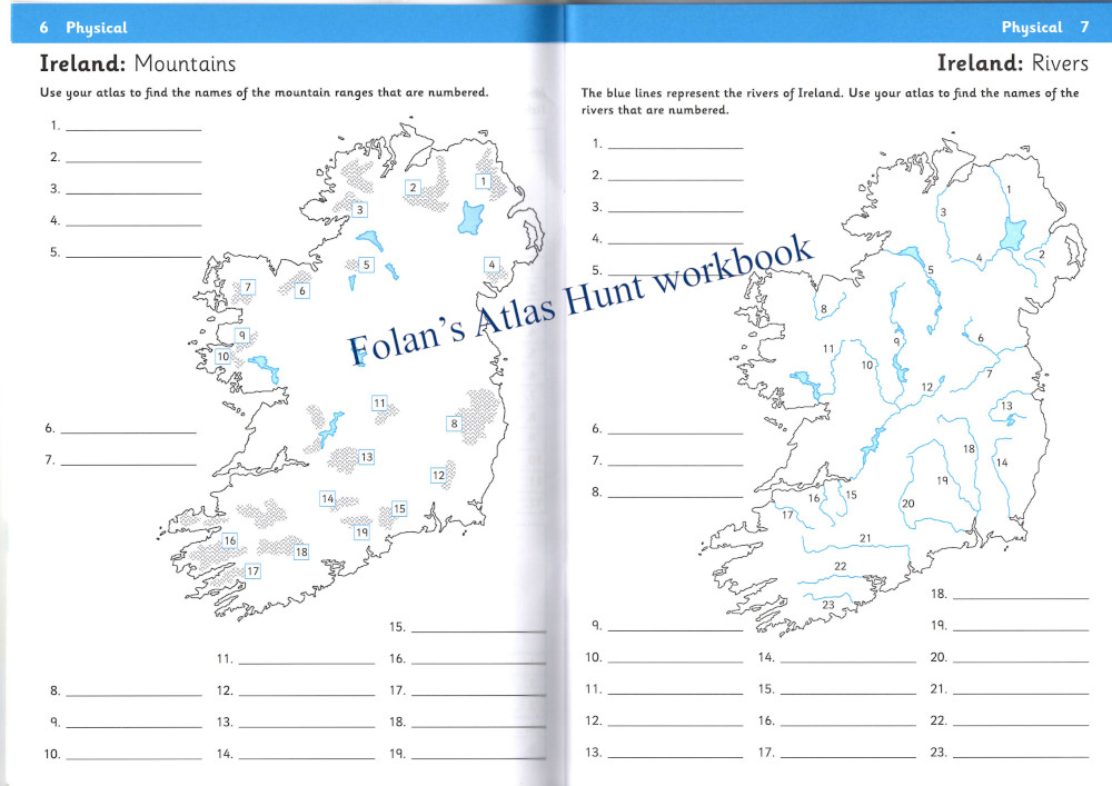
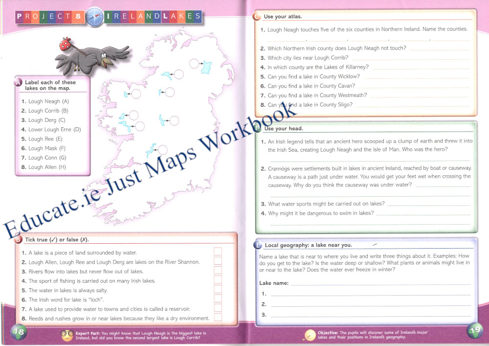
One friend has the game Where in Ireland? which is no longer in print, but worth buying if you see it second hand. The cards include counties, towns, rivers, lakes, islands and bays, but it is easy to use the rules, find a suitable map and create some cards. Create a card for each county, for example, and number them from 1 to 32. Have a unlabelled map of the Irish counties. And then follow the instructions. If you wanted to do this for rivers, mountains, etc then the maps in Folan’s Atlas Hunt workbook (image below) would suit this purpose.
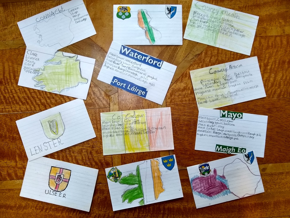
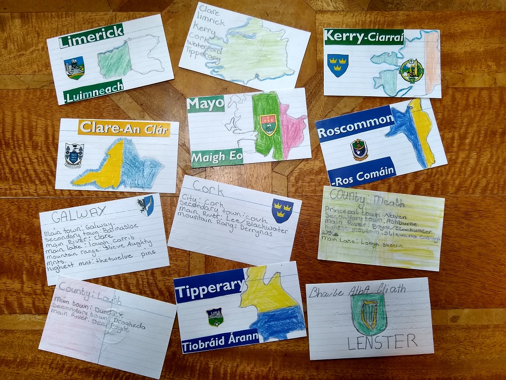
A friend had her children make a card for each county, which had information on like the name in both English and Irish, the county crest (glued on) and the county colours. Other information like county size and population as well as info like the county nickname, e.g. Cork the rebel county and Kerry the kingdom, could be added. These cards can then be used in the game above. If county size and population are included, they could be used in a game of war or like Top Trumps.
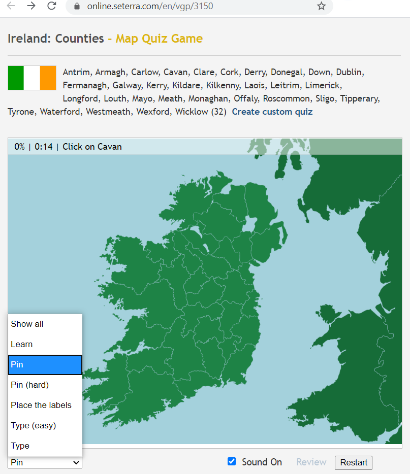
If you’d like an online option for practising the counties then try Seterra which has various online Irish counties map quizzes. Click on pin under the map to select the different types. Seterra also have an app. Sheppard Software also do geography quizzes, e.g. for countries and capitals by continent, but they don’t have one for the Irish counties.
Ireland101.com also have an online county quiz game.
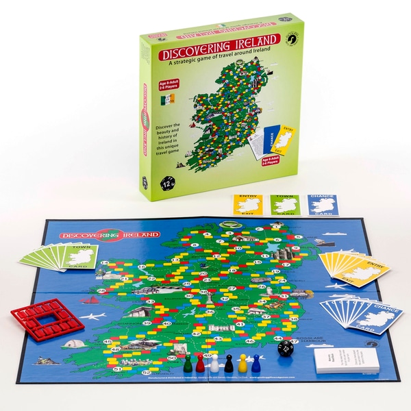
Moving on to learning the major cities and towns, the Discovering Ireland game (Smyths) is a nice gameschooling way to start learning them. Each card has some information abouthe town. I would recommend the full size one, rather than the travel one, which is too fiddly. We aware that if they just focus on looking for the towns by searching for the number only, they won’t actually learn the towns.
Books
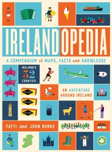
For non fiction the first suggestion is usually Irelandopedia (Amazon UK) where each page has a map of a county with lots of crazy pictures. My children did not like the pictures, but lots of children do. There are plenty of copies in the library to give it a try before you buy. A suggestion is to have this in the car when you go on day trips or on holidays in Ireland, as children can look at the county and find where you are going and what interests them in the county.
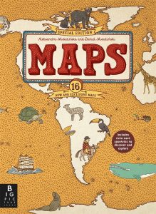
We used some of the Beautiful feet Around the World with Picture Books guides (which are wonderful and conveniently also available as a digital download). It uses the Maps book by Aleksandra Mizielinska and Daniel Mizielinski (Amazon UK). If you are looking at this map book, make sure to buy the newer “special edition” version. The special edition has a few extra maps including a two page map of Ireland.
Simply encouraging children to look for places mentioned in books, is a great way to improve their geography. I didn’t (yet!) find any Irish tales books which lent themselves well to this. (If you do know please let me know and thus others through this little blog!) I have seen some lovely ones from recommendations on other Charlotte Mason sites for other countries. We did do this when we came across places as we read some of the Irish myths.
Maps
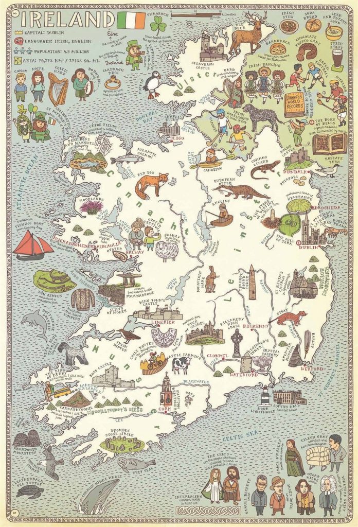
Which naturally leads me to mentioning having a few large maps on the wall. Our dining room wall is decorated with a 2m wide map of the world, and we have a large map of Europe and, of course, of Ireland. Our map of Ireland is 80cm wide so loads of detail (Amazon UK). And a globe is important too, especially to build an understanding of actual relative size, because of the distortions necessary in flat maps.
Workbooks
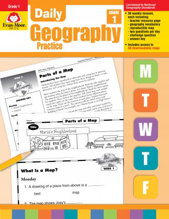
I used the lovely Evan-moor Daily Geography Practice Book for Grade 1 when my children were in Senior Infants/First class. This book gives a good grounding in geography concepts (including continents, oceans, compass directions and habitats). It can be bought as a physical book (Amazon UK) and the student pages can then be downloaded for free and printed for each child (my preference) or as an e-book. You can make a copy for each child with Evan-moor’s copyright. You can see a preview of the book on Evan-moor’s website.
This has worked well both times for my family, but for a more Charlotte Mason approach, Ambleside Online uses Charlotte Mason’s Elementary Geography and Long’s Home Geography for Primary Grades (Amazon UK). You can find nicely formatted free pdfs of them here. However, Evan-moor is what was realistic for us to get done, they learnt and understood the concepts in the book, and both my children enjoyed it.
I don’t want to go into much detail about non Irish specific geography in this post (there are many wonderful resources which do this) but to put this post in context, we used the Evan-moor book, we read a lot from quality literature where geography concepts naturally appear, we are working through the Story of the World doing its mapwork, and we use geography themed living books from Ambleside Online and Beautiful Feet. These over lap. For example Beautiful Feet’s Geography Through Literature which provides maps and a guide for the Hollings books which are on Ambleside Online. We have also used Beautiful Feet’s Around the World with Picture Books I and II) and have read more deeply about some countries with these.
Thus a lot of what was in some of the Irish geography school books was unnecessary (Including the series Folen’s Where on earth?, Folen’s Unlocking Geography and PrimEd’s Primary Geography). I wanted something that was going to focus just on Irish geography. Initially I bought Educate.ie’s Just Maps 3rd class, but it was not self-contained; which is fine if your happy for your child to go off and google for answers, but I really did not want that distraction for mine.
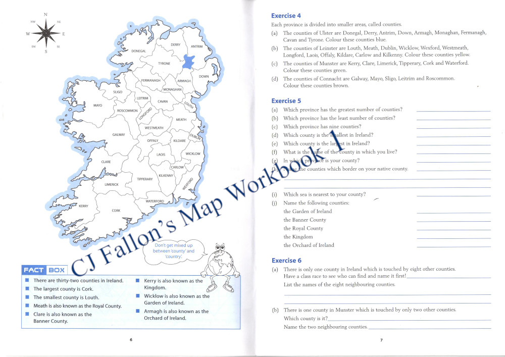
After more asking for advice and looking around at various workbooks other moms had bought, I had a seasoned home educating mom recommend CJ Fallon. CJ Fallon’s Map Skills 1 is a straightforward book for learning the names of each of these features and where they are located. We started this book when my daughter was in 2nd class. Note that, confusingly, CJ Fallon have a similarly sounding book – Map Workbook 1. Map Skills 1 is their newer version, and Map Workbook 1 is the book they created earlier, but which some schools are still using, and so both are currently available. While the latter is definitely functional and has the advantage of being black and white if you need to copy a few pages if you feel your child needs extra practise, I think the Map Skills book is better. It has more space to write in answers. Strangely Map Workbook 1 has 11 pages practising the names and locations of the Irish counties, whereas Map Skills has only 4 pages. Unfortunately, the newer book does not go through the Irish county names in Irish, so I will be adding that. (You could have done this with the county cards mentioned under Games above.) However, the newer book spends more time on each topic after working on counties, having a total of 72 pages vs 48 pages. It has a distance chart and a few questions using it, and a few pages using scales, which I think is a useful skill.
My recommendation is
CJ Fallon’s Map Skills 1 workbook
Both books include fact boxes with concise information.
I did have to locate and print a few images in order for this workbook to be completed without needing my child to head off to the pc:
- County coats of arms http://www.flag-designs.com/pack/ireland-counties-coas
- County colours (with coats of arms on) http://www.flag-designs.com/pack/ireland-county-gaa-flags
- County jerseys which I printed from the two images at this link https://www.farnacrafts.com/product/single-jersey-hurley-plaque/
Naturally any child following their county team for sports would be well acquainted with these.
The Map Skills 1 book is marked as 5th class, which initially put me off even picking it up, but the content is straightforward and actually ends up with a little less writing than the Just Maps book marked 3rd grade. We started Map Skills 1 in 2nd grade. We moved slowly through with the book and continued it into 3rd grade. I have no need for us to finish the book in a year.
It is possible to view the pdf answer key for Map Workbook 1 and 2 (the older one) on CJ Fallon’s website by registering as a home educator and using Roll Number: hschool. Unfortunately they don’t have an answer key up for Map Skills 1 and 2, although it only takes me a few minutes to figure the answers out. If you would like a plan for using Map Skills 1 over the year, CJ Fallon has this file on their website: Map-Skills-1-Yearly-Plan.docx.
CJ Fallon’s Map Skills 2 and Map Workbook 2 are world geography – countries, cities, physical features – and do not include any further Irish geography. They are very much the same in style to the 1st workbooks.
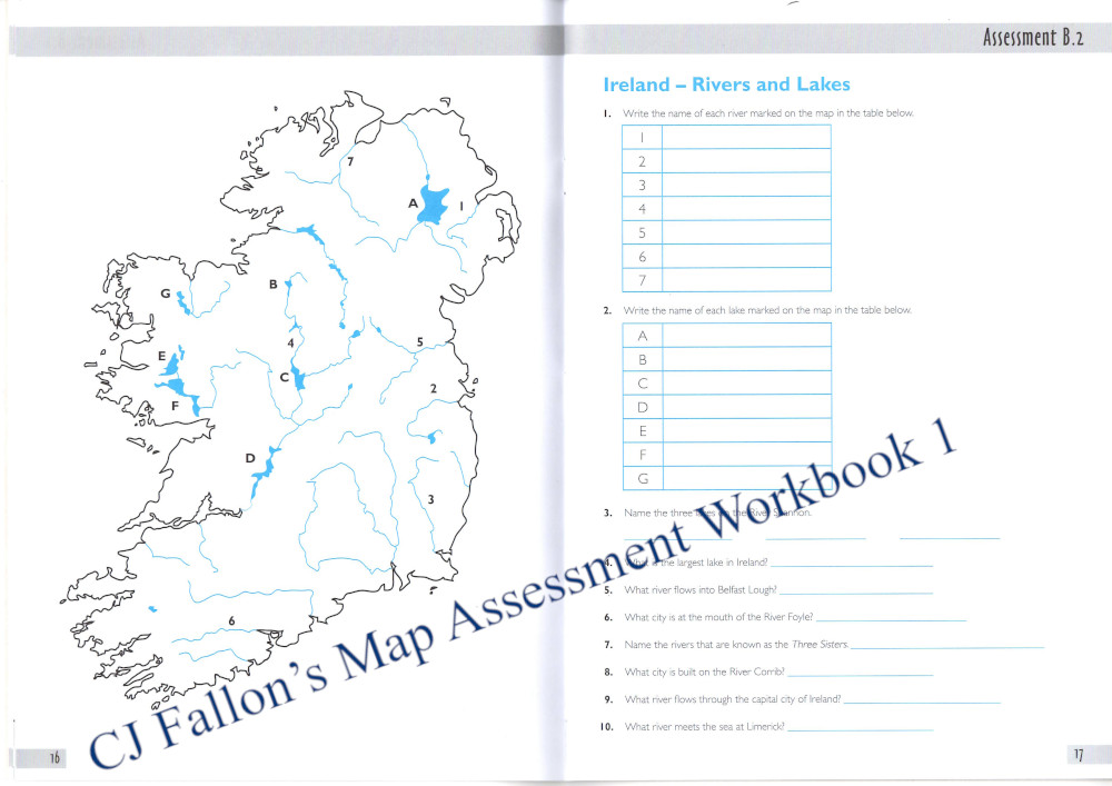
CJ Fallon’s Map Skills 1 and 2 come with Map Assessment workbooks. These are simple black and white with a few blue lines, which could be used for review. Only a selection of a feature is included for review, as shown in this page for rivers and lakes, so they would not really be suitable for Charlotte Mason map drill. CJ Fallon’s Map Skills and Map Assessment workbooks come bundled together in shrink wrap, thus you cannot see the workbooks before you purchase them.
The title of Atlas Hunt by Folens sounded like it would be fun, but when I finally saw it out of its plastic wrapper, it wasn’t. Just blank maps where you fill in the labels. You can see two pages inside above under Games. However, if you are going for a Charlotte Mason map drill style, where the child fills in a few labels on a blank map each day, then this one may suit you.
Unlike the Just Maps workbook, which requires the atlas by the same publisher in addition to googling for info, a specific atlas if not vital when using the CJ Fallon workbooks. I did realise that I wanted an Irish Atlas in addition to the standard world atlas we already had, as it includes a variety of types of maps of Ireland, for example climate, population density and geology which we can look at as discussion arises. I bought the All Around Me Primary Atlas, but I felt the Irish atlases were not overly different to each other.
Field Trips
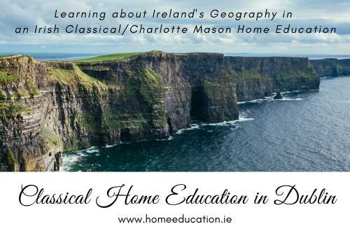
Geography is a subject full of wonderful opportunities to get outdoors to explore and develop their sense of place, locally, within your county, and nationally. We have this freedom. Learn about geographical features such as headlands by going for a walk up Howth head. Learn about bogs by visiting one. See it and experience it. Draw it, take pictures, write about it in your nature journal.
I will write up more detailed field trips ideas in future posts…
Click here to subscribe and I will let you know when I put up new posts, about once a month or so. Ensure you click the confirmation email to complete the process in order to receive emails.